Image copyright
PLANET LABS INC
When SpaceX puts up another batch of its Starlink satellites in the coming days, there’ll be three spacecraft from the Planet company catching the same Falcon rocket ride to orbit.
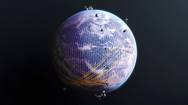
These companies – SpaceX and Planet – now operate the largest commercial constellations above our heads. SpaceX at over 450 satellites; Planet at more than 150.
SpaceX is targeting broadband communications; Planet is all about Earth observation, and this next launch marks a big milestone in the San Francisco outfit’s plans.
These next three platforms that go up with SpaceX will go into Planet’s SkySat network.
Already this comprises 15 spacecraft. The satellites were lowered in recent months from 500km in altitude to 450km, to increase their resolution. They now see any feature on the Earth’s surface larger than 50cm.
Image copyright
PLANET LABS INC
With the addition of the soon-to-launch threesome, and a further three about a month later, Planet will then have 21 of the high-resolution imagers circling the globe. At that point, the SkySats will be able to see any spot on the ground (cloud permitting) on average up seven times a day.
And mid-latitudes – eg, the UK – will be in a particular sweetspot. Super-sharp pictures will be available up to 12 times a day.
No other network comes close to this in terms of repeat visit at 50cm resolution. And with Planet’s “string of pearls” small sats, called Doves, which picture the entire Earth’s surface once a day at 3.7m resolution – the company is now very much in the era of “constant watch”.
“They’re both cool systems,” says Will Marshall, the British CEO and co-founder of Planet. “The Doves scan the Earth and are used to monitor large-scale phenomena, such as for agriculture and deforestation; while the SkySats are for pointing and tasking, where you need higher resolution imagery for things like making maps, hence our partnership with Google.”
Image copyright
PLANET LABS INC
Planet is now updating the portal, or Dashboard, that customers use to order the imagery they want.
It’s taking the human out of the loop. Where previously a staffer at the company would pick up the request and task the satellite, the Dashboard will in future do the job directly.
“Google is working on these self-healing maps where if anyone notices a map is out of date, it will automatically trigger a new SkySat collect that will bring a new image down, automatically recognise the buildings and roads and then automatically bring the map up to date. We want to enable that kind of ‘tips’ system and the automated provision of imagery to more people than just the very sophisticated clients like Google,” Dr Marshall told BBC News.

Media playback is unsupported on your device
There is an astonishing amount of data now being returned by Earth observation (EO) satellites. The archives of the big space agencies and companies are filling up with petabytes of information (one petabyte is roughly equivalent to 200,000 commonly used DVDs).
Optical and near-infrared imagery (essentially, what we see with our eyes and just beyond at the longer wavelengths of light) is the cornerstone of EO, and increasingly it will feature in everyday applications on the web and on people’s smartphones.
The future will be in using all this information in ever smarter ways; in using machine learning to pull out yet more relevant insights into the changes taking place across the surface of the globe.
Planet’s current 150 shoebox-sized Doves are being superseded by a new generation of small satellites that double, from four to eight, the number of colour bands recorded on their camera sensors. More than 20 of these new “Super Doves” will go up next week on a European Vega rocket.
Dr Marshall says Planet is in a state of constant iteration, exploiting the very latest processors, sensors, radios, and other component technologies to push the satellites’ capabilities. Spacecraft are launched and retired at a high cadence.
“Just as you don’t what a smartphone in your pocket that’s older than three years, we don’t want spacecraft in orbit older than three years,” he said.
“I definitely think this is Earth observation’s moment,” he added. “We’re moving towards this concept of a queryable Earth.”
Image copyright
PLANET LABS INC
Dr Marshall told BBC News: “We have cool satellites, and it’s fun to talk about them. And, obviously, it gets me excited as a space geek.
“But this is an information business. This is about providing insights that help people to make decisions, and that’s what matters.
“Most of our users don’t care what satellite the information comes from or how it got to them. They just care about how it helps them – as a farmer to help them optimise and reduce the amount of fertiliser on their land; or as a civil government to monitor regulations and enforcement; or as a coast guard to help stop illegal fishing.
“We’re trying to make EO easier and easier… to democratise its use and get benefit from it.”
Image copyright
PLANET LABS INC
Read MoreFeedzy


